
Directions/Route
Today we have a strenuous climb ahead of us and we should have enough water and provisions with us: we will only find the first stop and shop shortly before San Sebastián de la Gomera.
The first part of our hike is along the driveway that climbs up the eastern slope of the valley (as the smaller, less frequented of the two driveways). In order to reach this driveway from the larger main road, we leave it at the level of the "Parque Curato" (waypoint 1) and walk a short distance uphill to the right of the river until we reach a green metal pedestrian bridge (waypoint 2). At this point we cross the river and walk straight ahead into the small banana plantation. A short climb takes us to the “Las Nuevitas” cemetery and onto the aforementioned road, which we follow uphill for about 1 hour.
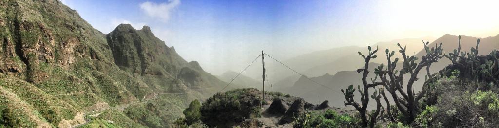
At the point where our small road meets the main road again, we turn left onto the steep path (San Sebastián is written here as 14.9 km, waypoint 3). The ascent is steep and strenuous, our gaze wanders back to the valley of Hermigua, which we keep leaving behind us. The path leads past a small lake further up and meets the main road again shortly after a covered rest area (waypoint 4). We cross this and continue our ascent on a narrow path. The trees on this side of the ridge are draped in shaggy lichens - it's hard to imagine that we'll come across cacti and agaves just a few hundred meters away as the crow flies.
About 3 hours after the start in Hermigua we reach the highest point of this stage at about 850 m (waypoint 5): In front of us is a long valley, usually spoiled by sunshine. The use of our telescopic hiking poles is particularly worthwhile when the descent begins, partly on loose scree.
Ripe cactus fruits smile at us again and again, which we harvest with fork and pocket knife, carefully peel and enjoy. Unfortunately, one or the other thorn gets lost on our lips - still a pleasure!
On the descent we meet the main road again, which has passed under our mountain in the tunnel (waypoint 6). We follow this a short distance downhill until our narrow hiking trail branches off again in the next bend (waypoint 7).
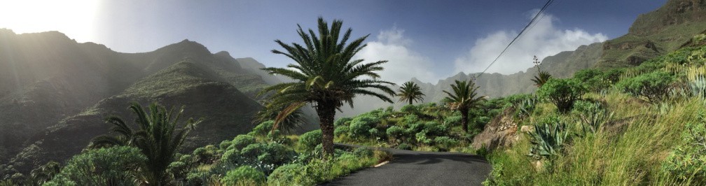
Further down, our path meets a paved road that will accompany us through the "Barranco de Aguajilva" to San Sebastián. The landscape changes the further we descend, nature becomes more and more lush and green.
We cross smaller settlements and with a bit of luck there is the possibility to stop here. Highly recommended is, for example, the small and rather inconspicuous "Bar El Atajo" (waypoint 8). From "El Atajo" it is about a 7 km walk on asphalt roads to the center of San Sebastián de la Gomera.
Variant 1: If this last section is too boring for you or if you don't like hiking on asphalt, you can order a taxi from "Bar El Atajo" (Tip from Stephanie in her field report).
Variant 2: Dorothee has discovered another variant for very sporty types (caution: approx. 4 km and an additional 650 meters in altitude!): From waypoint 8 "El Atajo" a steep path leads to the mountain ridge running parallel to the valley (see separate map), over which you can then hike in the direction of San Sebastián with great views.
Facts about stage 5
Altitude: 800m ascent / 950m descent
Route: 17.9 km
Duration: 6:30h (without breaks)
no refreshments on the way!