Stage 6: Directions
 Ascent from the beach "Playa de la Guancha"
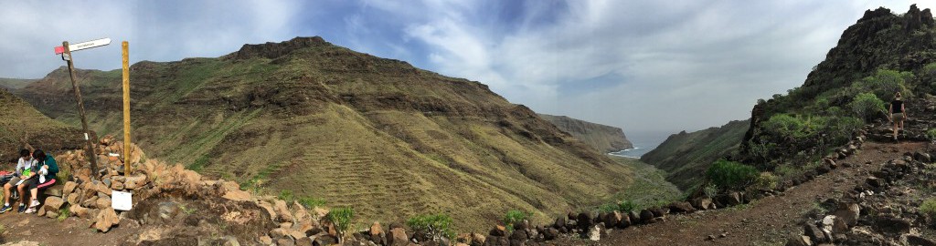
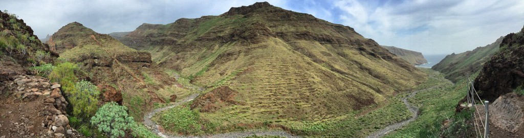
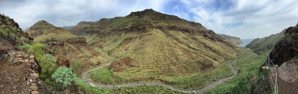
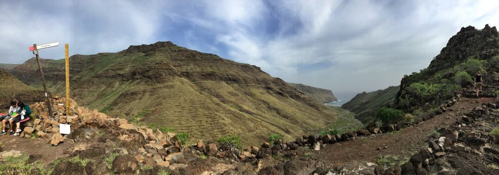
 Fork in the road to "Playa el Cabrito"
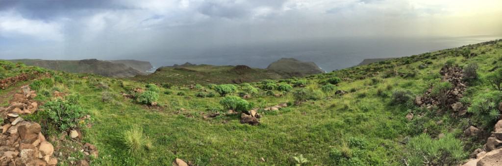
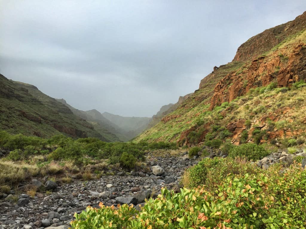
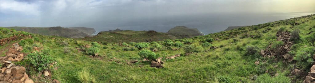 View from the highest point of the stage
Today is the last day of our circular hike and at around 21 km we have the longest of the six stages ahead of us!
Our tip: If you start on time today, you can catch the bus or the ferry back to San Sebastián at the stage destination - in other words: we can leave some of our luggage at the hotel if we plan the overnight stay accordingly.
Departure times for bus line 3 in Playa den Santiago back to San Sebastián de la Gomera (as of January 2016): Monday to Saturday 3:30 p.m. and 7:00 p.m., Sundays and public holidays only 5:30 p.m. Current departure times: www.guaguagomera.com.
Recently, it has also been possible to take the ferry back to San Sebastián de la Gomera, since Fred Olsen has expanded the ferry service - many thanks to Tamara and Simona for pointing this out! The current departure times can be found here: https://www.fredolsen.es/en (As of February 2018, 3 daily connections, last departure at 7:40 p.m.).
Danger: there are no shops on the way and hardly any shade on the route! It is advisable to take enough water with you!
Our hike starts at the short beach promenade of San Sebastián in a southwesterly direction. Immediately after the blue sports field (waypoint 1) we turn right onto a gravel road and walk towards the La Gomera power station. Directly behind (waypoint 2) the GR-132 leads up the slope to the left.
Soon the last houses have disappeared from our field of vision and we are only surrounded by the impressive landscape of stone, various bushes, daisy bushes and a never-ending view of the sea.
Facts about stage 6
Altitude: 1140m ascent / 1140m descent
Route: 21km
Duration: 7:30h (without breaks)
Route download - Stage 6 (GPX file)
All other downloads can be found at maps.
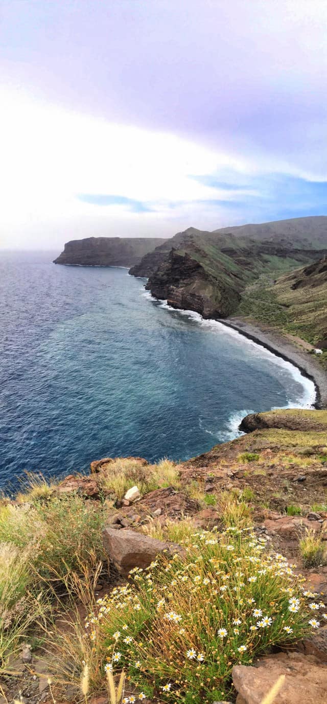
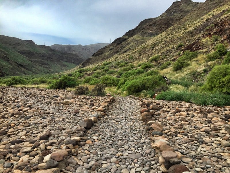
Playa de la Guancha
After a little over 1 hour we reach the first small beach, the "Playa de la Guancha". From there, a stone-lined path that cannot be overlooked leads into the valley. We follow this and soon climb the left slope to circumnavigate it from behind halfway up. After a short zigzag ascent with a beautiful view back into the valley, we reach a crossroads with a break bench at waypoint 4. Here we turn left, ie we initially go slightly uphill in a southerly direction. Shortly thereafter we climb down in narrow serpentines to the next beach. Down in the river bed (waypoint 5) we come across a wall behind which there is a road, which we follow to the beach.
Playa el Cabrito
A banana plantation used to be in this lonely valley. Today, the “Playa el Cabrito” is almost entirely taken up by an ecological hotel complex. The elongated, former banana hall, which is now used by the hotel as a dining room, is clearly visible from the beach. Danger: The hotel does not offer a restaurant service for external visitors and should therefore not be planned as a supply station!
The large switchbacks of our next ascent on the mountain flank behind the hotel are just as clearly visible. Leave the beach just behind the former banana hall and walk under the steep rock face behind the hotel grounds to the beginning of the ascent.
Arrived on the ridge (approx. 200 meters in altitude), we follow the path to the right - to the left the path only leads to a "dead end", albeit with a beautiful view.
Another climb takes us to about 380 meters in altitude, then we continue to 500 meters in altitude, where we finally meet the abandoned settlement "Morales" (waypoint 6). There we follow the signs towards Playa de Santiago. From now on it's a leisurely descent.
We cross “Contreras”, another abandoned settlement, and soon see the first houses of Playa de Santiago in the distance. Attention: the perspective belies the fact that there are still three medium-sized "Barrancos" (gorges) to be crossed with ascents and descents before you reach your destination!
Playa de Santiago
The path to Playa de Santiago is long because there are still many switchbacks and intermediate climbs to be overcome shortly before the destination. Some of these lead along the paved road, some have steeper shortcuts for pedestrians.
The last part of the way leads along the driveway past the golf course to the entrance of the large hotel complex "Hotel Jardín Tecina". The bus stop for the trip back to San Sebastián is a short distance further in the bend of the main road that crosses our path. If you have booked an overnight stay in the lower part of Playa de Santiago or want to take the ferry back to San Sebastián instead of the bus, you have to go down a little or another 1.5 km from here.
Stage 6: accommodation
Accommodation in Playa de Santiago
If you start hiking in time for stage 6, you can catch the bus back to San Sebastián in Playa de Santiago on time and stay there two nights in a row (our tip, see accommodation stage 5).
If you want to treat yourself to something special after the many highlights and meters of altitude at the end of the hike, we recommend the elegant Hotel Jardín Tecina in Playa de Santiago: The most luxurious hotel on the island is located right next to the golf course, has several restaurants and pools and offers nice Gimmicks such as a cocktail bar directly in the swimming pool (Link: Hotel Jardin Tecina). Incidentally, the hotel belongs to the Norwegian Fred Olsen Group, which also operates the ferry to Tenerife.